Mikhail Orekhov
The navigator in the car of a modern motorist is almost a necessity. Thanks to this functional gadget, you can safely go on a business trip or travel by private car, or simply move around the big city along the shortest routes, without wasting time and nerves. However, in order to fully use all the capabilities of the device, it is necessary to understand how to use the navigator in the car correctly.
When purchasing a navigator, you must carefully review its package contents in order to understand whether the device really meets the requirements. The kit must contain a Russian-language instruction in paper or electronic format. You will have to read the instructions before using, since different device models have their own characteristics: technical characteristics, operational requirements, connection and installation features, etc. Here you will also learn information about the capabilities of the selected model, the presence or absence of additional functions.
Pay attention to the presence of all elements, including batteries, connection cords for removable models. The setting of the operating mode and basic functions is carried out in accordance with the instruction manual.
Usually, sales assistants in stores explain how to use a GPS navigator and inform the buyer about the availability of basic and additional functions (if any). The main function of the gadget is navigation, but it can also be supported: watching videos, playing games, playing audio, and even an e-book.
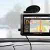
Installing the navigator
Before you can start using your navigator, you need to install it correctly. By type, this device can be either built-in or removable. The built-in navigators look like a radio tape recorder and are installed in the on-board system of the car. The removable device can be placed on the car panel or on the windshield. Other options are also possible. In principle, the driver can choose the place for fastening at his discretion, but it is important that the device does not interfere with following the road - does not obstruct the view. The set comes with a bracket or a stand, and sometimes both. Also, do not mount the navigator in the area where the airbags are located. Power is connected through the cigarette lighter. However, the navigator can work for some time even without connection, using the battery resource.
Learn to park correctly.
Device functionality and software
Many models come with software already installed. However, they must be activated before working with the navigator. The most commonly installed types of software are:
- CityGuide;
- Navitel;
- Navigator;
- The suburb.

Expensive models can provide the user with the choice of the software to be activated. In order to understand if this function is supported, go to the menu and see if there is a command "path to software". If it is, then the user can choose what exactly will work on his navigator.
After activating the program and connecting to the on-board network, the device starts searching for a signal from the satellite. Next, the location is automatically determined with the display of search results on the screen. In this case, the owner will be prompted to enter the following settings:
- Timezone;
- coordinate system;
- unit.
- selection of a suitable type of map, convenient rotation while driving;
- auto positioning mode (in the settings - "Car" - "Attraction");
- selection of the optimal route duration (short, normal or fast);
- choose which objects should be recognized as "unwanted" and avoided if possible.
Now you can proceed to the choice of routes and the correct introduction of settings - individual operating parameters, thanks to which the gadget will work with maximum adaptation to the needs of the driver. It is advisable to do this before using the navigator.
Paths and routes
In order to plan a route, you need to select a point on the map or set a destination. GPS navigators automatically determine the original location, so you do not need to indicate it. After the destination is set, you must click on the "go" or "follow" button. An arrow appears on the map page to indicate the direction. The object itself (car) will also be visible on the map, its movement can be monitored in real time.
A working navigator can offer various routing options. For example, by address, map, coordinates, or waypoints. Also, the device will allow the user to select a route from the menu: "nearest" or "favorite". It is important to understand that a track or path is a route that the driver has already followed using the navigator (the recording function can be disabled in the settings). A route is a route that the user has specified according to waypoints. Also, many devices have a "Track back" function, when turned on, the navigator will lead the driver back from his destination to the same points that he was driving initially.
After the destination is selected, the program automatically selects the optimal route according to individually specified parameters, taking into account the avoidance of unwanted objects, traffic jams, etc. In addition, the user can specify an additional point through which to build a route. For example, "supermarket" or "pharmacy". On the map, you can find the nearest facility that meets the requirement: the nearest pharmacy or grocery store to the route being planned. Now you know how to use the navigator correctly and you can get the most out of your gadget!
Probably, every smartphone user had to turn to the navigator for help. There are times when you are in a foreign city and do not know how to get to a certain place. Some in the old fashioned way ask passers-by, but not always there are those willing to answer you. If you have a smartphone, it is best to ask your navigator for help. Almost all young people know how to use the navigator on the phone. But older people, most likely, do not even know that there is such an application. In this article we will tell you how to use the navigator on your phone, as well as how to use it in the forest and without the Internet.
Using the navigator
Consider the instructions for using the navigator:
- First of all, you need to make sure that your phone model supports the navigation function. If your phone is an old model, which does not have this application, then, alas, you will have to purchase a new one.
- Download the application on the website or in the store, install it, and then you need to launch it. After starting, you will see several items: find an address, follow a route, search for a deposit, etc.
- If you need to find a specific establishment or a specific address, then you need to enter it - and the application will find the way for you.
- If this is your first time with the navigator, then practice with the nearest address, and you will see how it works.
- After entering the required address, the device will give you voice prompts about where you are going and where you need to turn.
- All that is required of you is attention, because if you turn in the wrong direction, the device can change the trajectory of the path to the required address.
- You can find a shortcut to the desired place yourself. You can also choose a voice that will notify you.
- If you need to get to a restaurant or store, then you need to select a location search, the navigator will find all suitable places for you.
Using the navigator without the Internet

A huge disadvantage in all navigators is that they only work via the Internet. And, as you know, mobile Internet is quite an expensive pleasure, and not everyone can afford to connect it. The Internet consumes data transfer limits and also drains the battery. This happens due to the constant connection to the Network. Many users ask the question: how to use the navigator on the phone without the Internet? The answer is pretty simple. There are now many applications that work without an internet connection. You can also download a map of any city that you need and use it without connecting to the Internet. You will be able to see directions through the saved map. How do I use the navigator on my phone? It's much easier with downloaded maps if you don't have access to the Net.
Navigators working without the Internet
With such applications, you will no longer have a question about how to use the navigator on your phone. Let's take a look at the most popular applications that do not require an Internet connection:
- SygicAuraMaps.
- MapDroyd.
- MaverickPro.
- NavfreeFree GPS.
Navigator and forest

Before you are going to go into the forest, you need to study all the settlements, roads and railways that are nearby. You also need to take a map and compass with you. If you do not have this or that thing - it does not matter, you can use your phone. You just need to download the navigator and compass. on the phone in the woods? Very simple, just like in the city. Once in the forest, save your location. And that's it, you can walk in the forest as long as you want. You can even turn off the phone so as not to drain the battery. Once enabled, it will show you where you are and where the starting point was. So don't worry about getting lost, go for a walk and enjoy the fresh air.
The GPS navigator is a device that makes it much easier for both motorists and pedestrians to navigate the way. Especially such a device is indispensable if you are in an unfamiliar city.
The main advantage of this device is the time we spend looking for the desired object. Surely many drivers faced a situation when, with the help of prompts from bystanders, they had to circle for hours in one area to no avail. With the navigator, such situations are excluded, although, of course, failures occur, but this is a rarity.
How to use the navigator correctly?
Let's note right away that the route that the navigator offers you is not always the best one. It's not about the device itself, most likely, the human factor plays a role here. Programs for navigators were written by people, and maps were drawn by people, respectively, the presence of errors is quite acceptable. How to use a gps navigator, while protecting yourself as much as possible from any inaccuracies? Compliance with simple rules will greatly facilitate this task.
How to start using the navigator?
After purchasing a GPS navigator (if its availability is not provided by the car model), it must be installed and configured.
The place for installation is selected individually, based on personal preference, manner, etc. However, it is very important to follow the general rules and recommendations of the installation, namely:
- the navigator should not block the driver's view;
- the built-in antenna of the device should not be drowned out by metal (car roof, metallized glass tinting, etc.);
- take into account the length of the charger cord in order to charge without first removing the navigator;
- correctly select the angle of inclination of the device so that the driver can see it, minimally distracting from the road;
- be careful not to shine the sun on the navigator screen to avoid glare.
To configure the device you need:
- Select Menu-> Settings-> Maps-> Top of the map and select "Rotate by motion".
- In the "Navigation" section, select "Car" and then the "Pull" item from the proposed one, which will allow you to determine the location of your car on the nearest road.
- In the "Route" menu, choose the most convenient route for you, short (if you need to shorten the distance) or fast (to save time).
- In the "What to avoid when planning a route" section, select from the list what you think is necessary. As a rule, these are: toll roads, dirt roads, U-turns, roads for truck traffic, etc.
How to use the navigator in the car: rules

Even if you are well versed in the settings and regularly follow the map updates and understand what, why and how to use a car navigator, it does not mean to rely on it one hundred percent and consider this device a panacea.
All modern smartphones and tablets on Android are equipped with a GPS module. This allows these devices to be used as GPS navigators. In addition, the presence of a GPS module allows you to leave GPS tags on photos and use many other useful functions. In this regard, many novice users are interested in how to enable GPS on Android. In this article, we will take a short look at this issue.
As a rule, the GPS module is enabled in Android devices. But, if you previously disabled this function, and now want to enable it back, then you need to open Settings and go to the "Location" section.
At the top of the "Location" section, there is a switch that is responsible for disabling and enabling GPS on Android.

If this switch is blue, it means that the GPS is on. In addition to simply turning on GPS, you can change the navigation mode. To do this, go to the "Mode. By device sensors ".

In the "Mode" section, you can choose one of three modes for determining your location.

Consider these modes:
- High accuracy. In this mode, all available information is used to determine the location: data from a GPS sensor, data obtained using a wireless Wi-Fi network, as well as data obtained using a mobile network. If you turn on GPS in this mode, you can determine your location with maximum accuracy.
- Saves battery power. The mode of operation intended for the device. In this mode, the GPS module. Instead, data obtained from a Wi-Fi wireless network and a mobile network is used to determine the location.
- By device sensors. In this mode, only information from the GPS module is used.
You can also enable or disable the use of your location data by Google services in the Location window. To do this, go to the "Sending geodata" section.

There are two additional sections in the Uploading Data section: Uploading Geodata and Location History. Open each of these sections and disable (or enable) the use of your location data.

Until relatively recently, the navigation software market offered users only expensive solutions from companies specializing in the production of such products. However, after Google's apps became freely available, competitors also had to make some concessions. Thus, users learned about the free Yandex.Navigator, which nowadays is able to work successfully even without the Internet.
Yandex.Navigator - description
Yandex.Navigator is a breakthrough in the field of navigation applications that helps drivers get from point "A" to point "B" in a much shorter period of time. The program itself will calculate how you can best get to the desired place, and will also take into account traffic jams and road events (accidents and accidents), road repairs and road closures. The driver is always offered several options (up to three) to overcome a certain segment of the road, with the fastest being listed first. In the event that the route will pass on a toll road, you will be warned about this.
When the car is in motion, the distance to go will be displayed on the screen of the device in use, measured not only in kilometers, but also in minutes. In order not to distract you from the traffic situation once again, the developers have also taken care of the voice guidance.
Appearance

The appearance of Yandex.Navigator (user interface) is one of the strengths of this application. The main screen has three tabs: "Search", "Map" and Favorites... In turn, translucent buttons are plotted on the map to change the scale (increase or decrease) and return to the display of the current position. There is also a compass and a traffic congestion indicator, where information is provided in points. By clicking on this indicator, you can turn off the display of information about traffic jams.
An interesting design solution is the multi-colored coloring of the line of the marked route. The choice of color (from red to green) depends on the intensity of vehicle traffic on a particular section of the road, and the load graph itself is presented as a thin multi-colored line placed above the map. Thanks to this feature, you can estimate the duration of the drive along the remaining section of the path, taking into account all possible obstacles. The time remaining to the destination is also shown on the map, but information about the current speed and other travel parameters remains hidden.
Functions
Among the main functions of Yandex.Navigator are the following:
building routes on the map (in more detail about how to drive coordinates into Yandex.Navigator, we will tell you a little later);
 execution of the driver's voice commands, that is, to plot a route or mark an accident on the map, simply speaking about it aloud. The driver turns to Yandex.Navigator and, after waiting for the corresponding sound signal, gives the command: for example, "Yandex, let's go to the station!"
Possibility of loading maps into the cache and their further use without access to the Internet. This feature sets the app apart from other similar ones.
How to use the program
Using Yandex.Navigator usually does not cause any difficulties in installation and operation, but there are still some peculiarities.
How to install Yandex.Navigator
First of all, it should be noted that the app can only work successfully with iOS or Android devices. This means that you can download Yandex.Navigator from the AppStore or PlayMarket. After downloading the application and confirming all permissions, the installation will begin.
 There is no need to download maps separately from the application, since they themselves are pulled from the Internet (of course, if the network connection is active) and are stored in the device's memory cache as needed. It is also worth remembering that you will not be able to download the entire map, as it happens in Yandex.Maps.
Yandex.Navigator does not require any special settings. To determine the location, the system Location API is used, which, in addition to GPS satellites, can also work through base stations or Wi-Fi (the function is activated in the operating system settings). As soon as you install the application on your smartphone, you can start using Yandex.Navigator.
How to customize the navigator
After reviewing the Yandex.Navigator settings, you will notice that they allow you to enable / disable automatic switching to the night mode of the map display, select the categories of custom points displayed on the screen, and also provide the ability to change the voice of prompts (male, female) or disable it. The settings also display the amount of memory that is used for caching cards (avoids the need for constant loading).
To customize the appearance of the map, you need to perform several sequential steps:
1. Click on the bottom of the screen;
2.
Press the "Menu" button; 
3. In this section, select:
"Map view" (used to enable the "Scheme", "Satellite" or "People's Map" modes).
Settings → Maps:
Night mode - activates the sparing screen mode when using the application at night. If the driver wants to control the mode manually, you need to select the "Enable" or "Disable" button. For automatic mode switching - press "Auto".
 Moreover, there are some other modes in the settings:
3D mode- turns on the volumetric display of the map.
Autoscale- helps to automatically change the scale of the map when the vehicle is moving.
"North is always at the top"- fixes the map relative to the cardinal points.
There is nothing complicated in the settings, which means that all that remains is to figure out how to use Yandex.Navigator correctly.
How to get directions
When the driver sets the route, the system automatically offers him two alternative travel options - the fastest and the shortest. Information about the length and time of the route segment can be seen on two tabs located at the top of the screen. The routes themselves are also visible on the map.
After the selection, the route will be laid only once and will not change in any way during movement. Even if the driver deviates from the set path, he will still remain the same, still being displayed on the map. How can you build a new route in Yandex.Navigator? In fact, you just need to reuse the search by specifying the name of the endpoint. Your location is automatically determined.
 You can set the route in another way - with a sound command. However, in this case, you need to speak clearly and distinctly, otherwise the application will not be able to recognize the command. It is better to turn off the voice prompts right away, as the program sometimes confuses "right" and "left".
How to use Yandex.Navigator without the Internet
There are situations when there is no internet connection and there is nowhere to look for it on the road. In this case, you should take care of the pointers in advance and download the necessary maps to your smartphone.
Which devices are suitable
The first versions of the Yandex.Navigator application differed in the need for a constant connection to the network. Despite the fact that the volume of transmitted data is not so great, there are still places where the mobile Internet is completely absent.
 It's good that the last update of the application already partially allows using Yandex Navigator without the Internet, and the owners of devices running on Android or iOS (including not only smartphones, but also iPads and Android tablets) have the opportunity to download a vector map of the region of interest to a special section of settings The new version of Yandex.Navigator is already available for download in the AppStore and Google Play.
How to enable the function
To activate the application without connecting to the Internet, you need:
1. Go to the Yandex.Navigator application installed on the device you are using (smartphone or tablet).
2. Go to the "Menu" section.
3. Press the button "Download maps" and select from the list of available regions, the one that suits you (you can find the desired area both by scrolling through the list and by searching).
 4.
Select one of the possible types of download: for example, "Overview" or "Full".
4.
Select one of the possible types of download: for example, "Overview" or "Full".
Thus, you can download maps in advance (when the Internet is available), and use them anywhere, even if there is no network.
Note!If the device you are using is equipped with a GPS module, then you can see your current location on the map and even determine where you are going without navigation.
The size of the downloaded file is always indicated next to the type of map, and it should be noted that sometimes it can be quite significant. This is why it is best to download over Wi-Fi. With further use, it will be possible to view the maps without connecting to the network, although building a route on the road will still require an Internet connection. That is, such a solution cannot be called completely autonomous. Downloaded vector maps only reduce the amount of data transferred, but even this is a significant advantage, and in some cases it turns out to be a real salvation for drivers who find themselves in an area without mobile operators coverage.
As a reminder, you can only find out how Yandex.Navigator works offline after updating the current version (if it has not been updated automatically).
Pros and cons of offline mode
There are several positive aspects of using the new feature:
 Firstly, if the Internet is completely absent, you can still view the previously downloaded map, and in the case when the device used also has a GPS module (which is not news for modern smartphones and tablets), it is possible to see your location.
Secondly, even with a working mobile Internet, maps will load much faster, and it doesn't matter if you just want to view them or set a route. In this case, no traffic is consumed.
Thirdly, the advantage of the updated version of Yandex.Navigator, which allows using the application in offline mode, is a vector map with a better appearance and a sharper image. Its volume is less than that of a raster one, which means that less space in the phone will be required. Moreover, all buildings in the updated version are three-dimensional.
Unfortunately, the matter was not limited to advantages alone, and the disadvantages of the updated version of Yandex.Navigator are also noticeable. The most significant of them is the impossibility of building a route without connecting to the Internet. However, if you have plotted a route in advance while the Internet is active, then it will be saved on the map (the presence of a GPS module will allow you to see your movement on the map). Also, do not forget that when you turn off a given route, a new one will not be laid.
In any case, as well as on devices with the Android operating system, using Yandex Navigator on the iPhone is a pleasure, because the journey with such a "assistant" is much more pleasant.
Subscribe to our feeds in