If in urban conditions it is easier for a driver or a pedestrian to navigate the road, then in the wilderness it is much more difficult. In such situations, navigation on a mobile phone will come to the rescue. Thanks to modern technology, it is now possible to use various programs, which greatly facilitates orientation in space. A beginner should figure out in more detail how to set up a navigator on a smartphone with an Android operating system and an iPhone, so that, if necessary, quickly find the right place.
Interface customization
The first thing that should be mentioned is the built-in GPS-navigator program, which is often supplied with mobile gadgets on Android. They are primarily aimed at pedestrians and cyclists. For orientation on the road, motorists are more suitable GPS devices. Most Android phones and iPhones have built-in GPS modules. Therefore, any mobile phone can be turned into a high-quality navigator.
Usually, a navigation utility is initially included in the OS of a mobile device - the most common are Google Maps. They are quite easy to use, but they need a constant connection to the Internet. And Android is so good that it allows you to implement any software depending on the needs of the user.
To configure the interface, you must enable the GPS module itself and the Internet connection, if possible. With internet support, the signal to the satellites arrives faster. Thus, the information on the location will be more reliable.
Step-by-step instructions on how to set up the navigator on your phone are presented in the table:
| Step | Photo step by step |
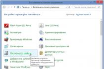
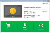
| They go into the settings and find one of the sections (depending on the brand of the gadget): "Location", "Geodata", "Geolocation". Move the icon to power-on mode. After that, it becomes possible to browse the applications that are available for navigation. |  |
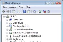
| In the "Mode" item, the required positions are selected - the accuracy and speed of position determination. The user receives the fastest information by simultaneously checking the columns "By network coordinates" and "By GPS satellites". But then the energy and traffic of the mobile device is consumed more. Slower communication with satellites is established if only "By satellites" is checked |  |
If the mobile gadget does not have a built-in navigation program, then the solution is to download a third-party application. There are many such for android systems and iOS. They differ in some technical indicators, for example, the purpose of use (orientation in the city or countryside). Most phones support GPS communication with Russian and American satellites. If other systems are involved, then it is not difficult to reconfigure the gadget for certain satellites.
All available navigation utilities applications are conditionally divided into 2 categories:
- working on already drawn up maps;
- focused on satellite imagery.
How to use Navitel
This application, like others, is downloaded from the Play Store. After downloading and launching the program, it is stored in the internal memory as a separate Navitel Content section, which includes another folder - Maps. It is into it that navigation maps are loaded.

After switching on, interaction with satellites occurs automatically, and when a connection is detected with at least one, the object's location is displayed on the map. The more satellites have joined the connection, the more accurately the coordinates are given. It should be noted that this application is paid.
Using Yandex. Maps "on a smartphone
The most common now are Yandex. Maps ”that support smartphones running Android OS. This is due to the extensive functionality, the extended interface in Russian and the lack of advertising. Another plus is that it is free to use.
To start working with the Yandex. Maps ", just start. After that, the program configures itself.
This utility functions both in satellite mode and card mode. For offline use, you can download a map of a specific city to your mobile device, which is available free of charge.

When orienting on the images received from satellites, a person is given the opportunity to move freely not only along roads, but also in any terrain. On the right are the keys responsible for the scale of the picture. In this regard, one must be careful, since multiple downloads of the same coordinate, but at different scaling, can overflow the system memory. Therefore, a regular cache cleanup is necessary.
If it is intended to use the navigator without access to the Internet, then all the necessary maps are downloaded in advance on the same scale.
How to install the application on a gadget:
- To install the navigator on the android go to the store and click on the "Install" icon. Waiting for the download to finish.

- To configure the application for personal use, they enter Yandex. Navigator "by pressing the corresponding icon on the smartphone screen.

- After the first launch, 2 consecutive requests from the program appear to gain access to geolocation and a microphone. Why give their consent.

- Further, a map with an arrow-shaped icon is revealed, by which you can find out your location.

- Click on "Menu" in the lower corner of the screen (on the right) and go to "Settings". A list of possibilities arises, among which they choose those that significantly affect the functionality of the navigator.

- In the "Map view" tab, you can select what you need - a standard route along streets and roads, or satellite coordination.

- To use the navigation system offline, you need to fill in a certain settlement in the search bar in the "Download maps" section. Choose your own in the drop-down list: city, country, region or province.

- You can change the location icon by going to the "Cursor" tab, where there are three possible options.

- Adjust the sound.

- They adjust the work of the voice assistant in the "Announcer" tab, where they indicate the specific voice acting.

- Select the language in which the navigator will be used. To do this, go to the subsection with the appropriate name and click on the required position. To return to the menu, click on the arrow in the upper corner.

- In the settings, it is recommended to leave all 3 activated options as they are. Voice interaction allows you to communicate with the device without leaving the road - they say the address along the route after the command "Listen to Yandex".

Rules for working with the navigator
After installing and configuring the utility on your smartphone or iPhone, you should figure out how to work with it further. This is not difficult if you first read the instructions.
First, the maps are loaded. Otherwise, the device will not function without wi-fi and mobile Internet.

Additional features designed for convenience:

This concludes the work with the fundamental options. The following are the auxiliary capabilities of the application. So, if there is no permanent Internet connection, but the maps are loaded or the route is saved in the memory, it is also possible to navigate through the mobile navigator. The scheme is similar to the online mode. And in order to save the already paved path, you need to click on the "My places" button and add all the necessary data.

Now all that remains is to voice the command and indicate the address of the place where the user is directed.
Working with tools
To manage tools go to the "Tools" menu tab, where a list of all available ones is displayed. This can only be done if the Internet is available.

In the "My trips" tab, activate this function by clicking the "Save" icon. After that, the navigator will remember all previously received information on movements. In the "Traffic police fines" section, you can view information about the driver's current penalties. To do this, click on the "Check" button. There is also the possibility of instant payment.
The "Roadside Assistance" tab is necessary for contacting in case of technical problems or the need to call a tow truck. After entering the section, indicate the location of the vehicle, the destination and the telephone number for communication.

These are all important points that you need to know before you start using the navigator on your mobile gadget. An acceptable alternative to Yandex. Maps ”will become Google Maps. Instead of Navitel, you can use the 2 GIS program.
Already from the name of the program, you can guess its purpose. The essence of the utility is to determine the current coordinates of the user based on the signals from the satellites of the world geo-positioning system (GPS) and the cell towers of the mobile network. The reader will be presented with instructions for downloading, installing and initial settings of the navigator application. The process of entering data for a route and following it is also described in detail.
Brief historical digression
In general, the idea of using a device to help a car driver determine his location is far from new. The first predecessor of modern electronic navigation devices appeared in 1920 in Great Britain.
The English version looked like a wristwatch. Special mini-rolls with printed maps of the area were inserted into them, the scrolling of which was carried out manually.
In 1930, a mechanical navigator was introduced for in-car use. Progress did not stand still: in the new device, the scrolling of paper maps took place automatically. Separately, it should be noted that the scrolling intensity directly depended on the current car speed.
Of course, there were no satellites at the time. If the driver turned onto a new road, he had to manually replace one card with another.
The idea of using satellite navigation to determine location came from the launch of the first Soviet satellite in 1957. It turned out that it is possible to use the signal reflected from the apparatus to determine the coordinates and speed of the object.
In 1974, the first GPS satellite was launched in the United States, initiating the development of a global positioning system.
General description of Yandex.Navigator
Yandex.Navigator is a free application that greatly simplifies the life of a car enthusiast who finds himself in an unfamiliar area. Below you will find instructions on how to use Yandex.Navigator.
The main features of the program are as follows:
- Plotting a route from the current point to a specified destination.
- Voice prompts while driving.
- Building the best route between two points on the map.
- View the map offline.
- Search for parking lots in large cities.
- Displays information about traffic jams along the route.
- Voice search function.
The user interface of the navigator is simple. It is not difficult to master it even for an inexperienced user.
System requirements
Before using Yandex.Navigator on your phone, you need to find out if the device meets the minimum system requirements. They are quite democratic. For comfortable operation of the navigation application, it is enough to use a mobile device with the following parameters:
- Processor with a clock speed of 1000 MHz.
- Display with a diagonal of 4 inches (it can be smaller, but it will be difficult to see anything).
- Availability of Wi-Fi and GPS modules.
- Operating system - Android version 4 and higher (there is also a version of the program for use with iOS).
Installation on a smartphone with Android operating system

In order to install "Yandex.Navigator" on a smartphone, you need to perform the following list of manipulations:
- Launch the Google Play Market application store.
- Write the name of the program in the search bar (in our case, it is "Yandex.Navigator").
- Click the magnifying glass icon.
- Tap on the "Install" button.
- Confirm permissions for the navigation software.
- Wait until the end of the installation process.

To start working with the installed Yandex.Navigator application, you need to go to the Android home screen, find the required icon and tap on it to launch the program.
Route planning and other basic functions
So how do you use Yandex.Navigator on Android? Below are brief instructions on how to use the functionality of the navigator application.
To start working with the program and make the initial settings, you need to do the following:
- Start navigation software.
- Wait until the GPS module finishes the procedure for determining its own coordinates.
- Touch the bottom of the smartphone display.
- The menu bar appears. To search, click the magnifying glass icon.
- Set search parameters, find the required address (or coordinates).
- Press the "Let's go" button to start moving along the specified route. To change the scale, simply touch the on-screen plus or minus icons.
- The color of the line of the paved route can change from green to red, depending on the intensity of traffic jams along the route of the car.

Also in the settings you can select the type of map display. There are three options:
- Scheme. Maps drawn by cartographers are displayed. There are street signatures and house numbers. Various organizations are also labeled.
- Satellite. In this case, the background for the map is a satellite photograph of the area. Sometimes it is easier to navigate in an unfamiliar settlement using a photograph.
- People's. This category includes amateur maps created by Internet users. Their use is relevant in the absence of official versions of maps for the desired locality.
Other settings of the navigation application:
- Selecting the type of interface display (day or night). In the second case, the screen colors are inverted for better perception of information in the dark.
- Choice of voice guidance. You can choose one of three options: no voice, female, male.
Using maps offline
Many people working with the application have a question about how to use Yandex.Navigator without the Internet. Without access to the network, you can use maps downloaded in advance from the network. To download them to your device, you need to do the following:
- Activate the Internet connection on the mobile device.
- Launch the Yandex.Navigator application.
- Enter the main menu of the program.
- Next, you will need to enter the name of the city and download the proposed map file.

After downloading, the map will become available for viewing even without a network connection.
Functionality available without an Internet connection
Nevertheless, it is necessary to finally clarify whether it is possible to use Yandex.Navigator without the Internet. It is difficult to give an unequivocal answer to this question. Despite the use of satellite signals, positioning is also carried out with the participation of the Internet and Wi-Fi access points. In other words, without an active connection to 3G / 4G networks, the navigation program will not fully function.
In such a situation, the user can only view the previously loaded maps of certain settlements, while active navigation and route guidance are not available in offline mode.
If you have never used a navigator before, you might think that, like many other devices, it requires some special skills from its owner and it is easy to learn how to use it. However, this is not at all the case. It is quite simple to install and then set up and work with the navigator, in addition, the set with the device always contains instructions for use, and if not in paper, then in electronic form it is obligatory! So, before you start working with a GPS navigator and go on your first journey with this technique, you need to install it.
How to learn to use the navigator in the car?
So, if you purchase a car navigator, then a stand and a bracket are always supplied with it. A bracket in a car is usually installed on the front of the car or on the windshield. There are other locations, however, with glass and panel being the most common. The terms of use state that the GPS navigator must not be placed where it will interfere with vehicle control, or where it will obscure the view. In addition, the equipment does not need to be mounted where the airbags are located.
Very often, the device is sold with a discharged battery, so it is impossible to use it. In this case, it must be charged either with a mains charger or via a USB cable (it all depends on the configuration). If it is a car navigator, then it can also be charged through a car charger.
Each model of GPS navigator displays marked points, trajectory of the traversed path, geographic coordinates of the point where you are and, accordingly, your device, as well as your current position. Also, each device has several pages that display various information: a map with traversed paths and points, position in the sky of satellites, a page for me with search and access to various settings, a navigation page, as well as a trip computer page where speed can be displayed movement, distance traveled and so on.
The use of a GPS navigator assumes this function as well. As a rule, for this it is enough to press, and then hold down the button specially designated for this for a short time. The same function can be performed through the navigator menu.
Instructions (rules) for finding a point that you "remember"
In order to find a point, you must first select it from the list of existing ones, and then press the "Go" button. An arrow will appear on the page titled "navigation", which will show you in which direction to move.
What are routes and paths and how to use them correctly?
 A track or path is a trail that you have already traveled. Thanks to the factory settings, it is written to the device memory by default. However, this feature can be disabled if you do not need it.
A route or route is one that has been marked in advance by points. In navigation mode, the device can guide you both along the track (Track back) and along the route. You can also first build a route on your computer, and then enter it into the device. But you can also build on the navigator itself.
Track back function - instructions for use
This function is a mode in which your navigator takes you back exactly along the path that was covered. The arrow on the "Navigation" page shows the turns.
How to use a barometric altimeter correctly?
All GPS navigators determine vertical coordinates. In this case, the elevation above the geometrical theoretical figure of the earth is determined. In order to determine the exact height above any surface (including above sea level), it is necessary to use a barometric altimeter. At the same time, it should be remembered that fishermen do not need height, but the presence of a pressure change graph in the navigator.
Video about using navigators
26.04.2017
Every year, progress is faster and faster around the world. Previously, we did not dare to imagine that someday there will come a time where people will be able to visit exhibitions and museums that are thousands of kilometers away using the Internet or follow a satellite route using a navigation system.

However, that time has come, and today we live in it. The invention of the navigator was very helpful to drivers, and now you and I do not need to use maps to arrive at the final destination of the trip. And that's great. By turning on the navigator and setting up the route, you can enjoy the road and pleasant voice accompanying the trip.

If you bought the navigator for the first time, then we are ready to tell you how to quickly learn how to use it.

Getting started using the navigator
The first step after purchasing a navigator is to configure it. So:
- Turn on the device
- After that, you will see on the display that the navigator is looking for a satellite
- An indication that a signal has been found will be the word "POSITION". Now you have the opportunity to see and study your location
- For the convenience of using the map, go to the "Menu", and from there to the "Settings". Find the name "Map", then "Up Map". Here you will see the names "north up" and "rotate by movement". To make it easier to use the card, select the second name
- To build a route and start moving, open the "Menu", and find the item "by address"
- In the windows that appear, enter the address where you want to go. Then click on the "go" button
- After these actions, the route will be laid, and you can start moving
You can change the route generated by the system. Let's say you need to go somewhere along the way, then:
- Simply move the map to the desired location on the navigator display, capture and name the waypoint
- Now click "find" - "waypoints", and select the desired name of the settlement. You will see the inscription "show on the map". Click there, and after opening the map of the place you need, click "call in"
- After all this, the system will reconfigure the route, travel time and mileage. Just don't forget to save new routes using the "export" button
If you do not want to drive through a dirt road or a toll highway, then set "avoid when planning a route" in the settings. And when it is important for you to drive the shortest way, then on the contrary, set up the system for all possible roads that the satellite can "see". Or if you want to know where nearby hotels, restaurants, shops are located, you can specify this in the settings. It is also very convenient when the navigator is connected to the Internet. Then you will have the opportunity to monitor traffic jams and congestion, and find ways to avoid them.
conclusions
The navigator is an extremely handy thing. With the help of it, you will not get lost, no matter where you hit the light. Plus, he will show you all the DPS posts, and control the speed of your car. Just do not forget to regularly update the maps in the system. You can do this yourself by downloading updates via the Internet or give your device to the wizard, who will not only update it, but also install a map of any country you want.
The auto-portal site also has groups: Odnoklassniki, and In contact with... Join us!
Do you like the news? Tell your friends! Found a mistake or typo?Select it and press Ctrl + Enter
Subscribe to our channel in Yandex.Zen
Many motorists have difficulty driving through roundabouts. This is not surprising, since the rules for such intersections have been edited more than once.

So, in particular, in the fall of 2017, it was decided to give priority to vehicles that move in a circle. And everything related to the rules for entering and leaving the ring remained unchanged.

The rules are allowed to enter the discussed type of intersection from any lane, but only to the far right. In this case, before carrying out the maneuver, it is necessary to notify other road users about this by turning on the turn signal.
Moving along the ring, you should turn on the turn signals in situations when you decide to change lanes, or you need to leave the intersection.
Leaving such an intersection in the absence of signs indicating the direction of movement along the lanes is allowed only from the extreme right lane. If you do this from a different lane, you can provoke an accident.
If the maneuver was not carried out as stipulated in the rules, the driver will be fined 500 rubles in accordance with Art. 12.14 of the Administrative Code of the Russian Federation.
In the US, startups and car sharing companies such as Turo have faced opposition from legislators to gain regulation.

The bill that turned Illinois into the center of a heated car-sharing debate last year began as a proposal for what happens when a rental car gets stolen. A bill that would allow car rental companies to punish customers if they don't return the keys to a stolen car and submit a police report has passed unanimously through the state Senate. However, as expected, it sparked controversy in the House of Representatives. The amendment then struck out all the language from the bill and replaced it with a plan to regulate sites that allow people to rent their cars to strangers.
The new wording echoed the priorities of Enterprise Holdings Inc., America's largest car rental company, which pays tens of thousands of dollars annually to political candidates and parties in the United States. Last year, the traditional car rental industry began pushing for new government regulations for upstarts, in part through its trade group, the American Car Rental Association.
The crux of the Illinois law and many other bills that the rental industry has supported over the past year is that the rules and taxes that apply to traditional rental companies should also be imposed on car sharing platforms, Bloomberg writes. The proposed rules pose a significant threat to Turo Inc., one of the most popular car sharing startups.
According to experts, car-sharing platforms have undermined their own credibility through unfair actions. The traditional car rental industry is pitted against car-sharing startups in at least 20 US states.
The main issue in the debate is how to define car division. Just as Airbnb has insisted it has nothing to do with hotels and Uber is unhappy with running a taxi service, a group of car-sharing startups say it does not rent cars, but acts as an intermediary in transactions between people. who use their services.
Critics say startups are mostly interested in minimizing tax liabilities. Market representatives do not deny this. They also facilitated transactions at or around airports without paying the fees that car rental companies use to operate. This led to several lawsuits, some of which are still ongoing.
Mitsubishi will show a special version of the Xpander compact van at IIMS 2019 in Jakarta.

The Mitsubishi press center showed the first teasers of the car the day before. The pictures show that the Xpander Special Edition now has a few "sporty tweaks".

These include tinted optics, decorative stickers on side mirrors and doors, and original light alloy wheel rims. There is also information that the interior Mitsubishi will have red accents and exclusive leather trim.

The Xpander went on sale in October 2017. Externally, the compact MPV has a good design, a proprietary radiator grill and two-level front optics.

Mitsubishi has a seven-seater, three-row saloon.

Under the hood, it has a 1.5-liter naturally aspirated engine with 120 horsepower. A 5-speed manual box will work in tandem with it, but a 4-band automatic is also available.

By the way, the manufacturer also announced a new economical 1.3 liter gasoline engine, which will make Mitsubishi Xpander, popular in ASEAN countries, even more in demand.
Also, the compact MPV boasts six airbags, an engine start button, a dynamic stabilization system, a circular video review system, a Smartphone Link Display multimedia complex and a panoramic roof with an electric sunroof.
If translated into rubles, then the price tag of the basic cross-van in Asia starts at 850 thousand.
The AC Cobra 260 Mark I version, having rather modest dimensions (up to 4 meters), is a real sports car. The machine is equipped with a power unit with high power and displacement.

The father of the legendary sports car was former race car driver Carroll Shelby, who founded a special racing school in Los Angeles. He constantly thought about creating his own sports car.

Shelby proposed to the growing British company AC to build a new roadster based on the Ace model. In search of a powerful suitable engine, the American submitted a sports car project to the management of Ford. As a result, Carroll Shelby received the right to install a Ford power unit on the Cobra.
In the future, each such model was equipped with V-shaped "eights" Ford.
The second party to the agreement is the Ministry of Industry and Trade of the Russian Federation. The purpose of concluding such an agreement is to support the brands that are part of the concern in Russia, as well as to improve production. This information was published by the press service of the company.

According to Janik Bezar, who is the CEO of the company in the Eurasian region, local production is part of a long-term development program in Russia, developed by the company's specialists. The company is ready to invest in the country's economy, due to the increase in the production of cars and their supply for export.
Due to the increase in production volumes, the plant switched to a two-shift work schedule, which created an additional 440 jobs.
Android smartphones have won universal acclaim. Both schoolchildren and retired elderly people use mobile devices. The main advantage of a smartphone over a regular phone is its wide capabilities.
First, the device has an operating system that allows you to install additional software, replacing inconvenient preinstalled programs or even missing features. For example, using third-party applications, you can significantly improve the quality of photos and videos.
Secondly, any, even the cheapest smartphone has an impressive number of modules. Usually, Android mobile devices have several cameras, a sensor, proximity, gyroscope, magnetic sensor, GPS navigator and much more. In addition, the device on Android, by default, must have a productive filling in order for the operating system to start and function on it. Thus, a phone on operating system 4.4 should have at least 1 gigabyte of RAM and a quad-core processor.
Navigation function
One of the most interesting sensors is the so-called GPS module. This sensor is installed in almost all smartphones, because thanks to it, the following applications gain access to the user's geodata:
Weather forecast - the application automatically shows the weather forecast for the region in which the person is located, while the user does not need to fill in the place of residence. Moreover, when a person moves, the application automatically changes its location.
-Browsers - if a person visits a particular resource, the browser knows its location in advance, offering the latest news, language settings and much more.
-Clients for social networks - it is much more convenient when the list of possible friends includes people from the same city or country as the user himself.
-Navigation - programs that directly track the location of a person on the map.
Before purchasing a smartphone, the buyer should pay special attention to the presence of a GPS module. Indeed, in some smartphones, only A-GPS navigation is used, which requires a constant Internet connection.
Comparison and selection of the navigator
Since the smartphone has an operating system, any number of navigation applications can be installed on it. Nevertheless, the most popular and multifunctional of them are:
Google Maps is a free application, the advantage of which is synchronization with Google services. The program allows you to view the map in normal mode and satellite mode. Unfortunately, the offline version has many limitations. In addition, the application interface is rather complicated for the average user.
Yandex Maps has long been a favorite navigation tool for taxi drivers. The program shows traffic jams and traffic congestion, works in both normal and satellite modes. Unlike Google Maps, Yandex allows you to cache satellite images to your phone's memory. In other words, a person can pre-download the site he needs in order to use it later. Unfortunately, many functions are implemented exclusively in large cities of Russia, while in some other CIS countries, the application has partial restrictions.
Navitel - Despite the fact that the application does not have satellite images and is paid, it is Navitel that comes closest to professional navigation tools. Among the navigation tools there are many sensors that determine the speed of movement, odometer, sunrise and sunset times, and much more. In the application settings, there are several profiles for using the smartphone by a pedestrian, cyclist, motorist or when traveling by public transport.
Presetting Navitel
Before starting the program, you must enable navigation in the GPS settings. The launched application will not immediately start working, because it may take a certain amount of time to search and connect to satellites. The speed of connecting to satellites depends on both the smartphone itself and the weather conditions. In clear weather, the smartphone connects faster to satellites.
At the top of the application, there is a satellite dish sign, by clicking on which, the user enters the menu, in this menu, select the "Satellites" section. In the tab that opens, a person can see how many satellites the smartphone is connected to. Active satellites are indicated by green bars.
Another, the most important setting is switching navigation modes, for this you need to open the menu, enter the settings and go to the "Navigation" section. In the navigation section, the first parameter allows you to select the type of navigation, for example, "Pedestrian".
Route creation
As soon as the application connects to at least one satellite, Navitel will indicate the user's current location on the map. To build a route, a person can move in any convenient way along the map, after which, tap the desired object. The next step, the person clicks on the "Cursor" parameter (at the bottom of the screen) and presses the "Let's go" button. If the path to the desired object is long enough, the application may take several minutes to plot the route.
Another way to create a route is to define the destination via a menu. To create a route, you need to call the menu, go to the section "Route", "Create a route", "By address" where one by one specify the country, city, street, and house. After specifying all the parameters, Navitel will show the final result on the map and the user will only have to press the "Let's go" button.
Summing up, it can be noted that for users who do not want to pay for navigation, there are other applications similar to Navitel, only free. In addition, you can give one little advice, when working with Navitel, you can not use the Internet, and yet, if the user has the opportunity to use the Internet, it is better to do this, because when the Internet is turned on, the A-GPS function is activated, thanks to which, the search process satellites is significantly accelerated.