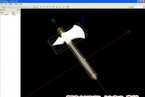
CONTENT AND STRUCTURE OF TEST MATERIALS Thematic structure GEOINFORMATION SYSTEMS Geoinformation systems: general questions Data types and their sources Cartographic bases of GIS Data models Input, output, storage and visualization Features of GIS application in ecology Content of test materials GEOINFORMATION SYSTEMS Geoinformation systems: general questions 0 An information repository equipped with procedures for entering, searching, placing and issuing information is called ... information system database data bank library called... maps graphs charts reports 3. Task (( 3 )) TK 4 Topic 1-0-0 Most effective method identification of geographical patterns in the formation of knowledge bases included in GIS is called ... cartographic analysis statistical analysis mathematical analysis scientific reports 4. Task (( 4 )) TOR 5 Topic 1-0-0 According to analysts ...% of all data have spatial component 80 25 50 90 5. Task (( 5 )) TK 7 Theme 1-0-0 The difference between GIS and other information systems is that they ... allow you to display and analyze any geographically referenced information allow display qualitative and quantitative information use modern methods statistical analysis study environmental patterns 6. Task (( 6 )) TK 8 Topic 1-0-0 The study of any spatial phenomena, processes or objects by building and studying their models is called ... geomodeling spatial analysis geometric modeling systemic analysis 7. Task (( 7 )) TOR 9 Topic 1-0-0 Chronological sequence of stages of the historical development of GIS ... 1: Pioneering period 2: State influence period 3: Commercial development period 4: User period 8. Task (( 8 )) TK 10 Topic 1-0-0 First software package GIS, which effectively used the user qualities of personal computers, is. … ARC/INFO PANORAMA ArcView 1 for Windows MapInfo Geograph 9. Task (( 9 )) TOR 11 Topic 1-0-0 The use of scanning to automate the process of entering geodata was first used ... by the creators of GIS Canada US Census Bureau researchers ESRI GIS developers Russian GIS developers 10. Task (( 10 )) TOR 12 Topic 1-0-0 The most popular GIS company is… ESRI Intergraph 11. Task (( 11 )) TOR 13 Topic 1-0-0 A feature that is not included in the GIS classification system is ... purpose problem-thematic orientation territorial scope way of organizing geographic data hardware 12. Task (( 12 )) TOR 14 Topic 1 -0-0 GIS classification method by territorial scope does not include… global nationwide regional local municipal inventory 13. Task (( 13 )) TOR 15 Topic 1-0-0 GIS classification method by purpose does not include includes… monitoring GIS inventory GIS research GIS educational GIS regional GIS 14. Task (( 14 )) TK 16 Theme 1-0-0 environmental nature management socio-economic land cadastral 15. Task (( 15 )) TOR 17 Topic 1-0-0 A component that is not part of the Geographic Information System is called ... hardware software data performers and users state statistical reporting system 16. Task (( 16 )) TOR 18 Topic 1-0-0 GIS component to which personal computers , is called… hardware peripheral equipment software data , are called ... software database management system user interface hardware 18. Task (( 18 )) TK 20 Topic 1-0-0 Information describing the qualitative and quantitative parameters of objects is classified as ... attribute data geographic data vector data tabular data data 20. Task (( 20 )) TK 22 Topic 1-0-0 The means of presenting data, with which visual illustrative maps and diagrams are created, is called ... visualization ... organization zation and management of information processing and analysis data vectorization 21. Task (( 21 )) TK 25 Topic 1-0-0 Software that allows for a systematic analysis of information about the state of the environment belongs to ... the level of eco-information systems medium lower upper 22. Task (( 22 )) TK No. 29 Omitted A scientific discipline closely related to GIS is called, ... Correct answers: cartography; 23. Task (( 23 )) TK No. 30 The key component of the GIS, missing in the figure, is called ... Correct answers: data; 24. Task (( 24 )) TOR No. 31 The diagram shown in the figure shows… GIS structure GIS functions main components of GIS 25. Task (( 25 )) TOR No. 32 The diagram shows… GIS main components of GIS Types of data and their sources 26. Task (( 26 )) TOR No. 28 Mark the correct answer Geodetic measurements of natural objects, as well as geobotanical methods belong to ... literary data sources statistical data sources field research data 27. Task (( 27 )) TK No. 29 Mark the correct answer Information about the location of data, their quality, composition, content, origin is called ... metadata attribute data geospatial data 28. Task (( 28 )) TK 1 Topic 1- 0-0 Information about data storage metrics and characteristics is called… metadata attribute data spatial data 29. Task (( 29 )) TK 4 Topic 1-0-0 Depending on the subject and purpose of the work being carried out, data can be ... basic additional digital non-digital primary 30. Task (( 30 )) TK 5 Topic 1-0- 0 In relation to time, the data are divided into ... modern old main additional additional 32. Task (( 32 )) TK 7 Topic 1-0-0 Data obtained as a result of processing and transformation of primary data are called ... primary secondary main additional 33. Task (( 33 )) TK 8 Topic 1 -0-0 The most common sources of data in geoinformatics are… cartographic statistical literary 34. Task (( 34 )) TK 9 Topic 1-0-0 statistical letter turn 35. Task (( 35 )) TK 10 Topic 1-0-0 Various information about the relief, hydrography, soil and vegetation cover, settlements, economic objects, communication routes contain ... general geographical maps thematic maps geographical atlases 36. Task (( 36 )) TK 11 Topic 1-0-0 They are not sufficiently accurate ... thematic maps general geographical maps geographical atlases 37. Task (( 37 )) TK 12 Topic 1-0-0 GIS databases and electronic atlases serve ... thematic maps general geographic maps geographical atlases territorial coverage way of organizing geographic data hardware 39. Task (( 39 )) TOR 14 Topic 1-0-0 Scientific direction based on the collection of information about the Earth's surface without actual contact with it, is called ... remote sensing geodesy geography cartography 40. Task (( 40 )) TK 15 Topic 1-0-0 funds 41. Task (( 41 )) TOR 17 Theme 1-0-0 The main supplier of statistical information of a geographical nature are ... measuring and observation stationary networks remote sensing data results of field surveys 42. Task (( 42 )) TOR 18 Topic 1-0-0 Various tabular data on socio-economic indicators refer to ... statistical data remote sensing data literary data 43. Task (( 43 )) TOR 19 Topic 1- 0-0 Information describing the qualitative and quantitative parameters of objects is classified as... attribute data geographic data vector data tabular data 44. Task (( 44 )) TOR 20 Topic 1-0-0 General program, a unified measurement technique and centralization are typical for ... statistical data remote sensing data literature data 45. Task (( 45 )) TK 21 Topic 1-0-0 We are engaged in the collection and processing of statistical data of a socio-economic nature in our country. .. State Statistics Committee Ministry of Natural Resources Rostekhnadzor 46. Task (( 46 )) TOR 23 Topic 1-0-0 , fund literature are presented in a classified form 47. Task (( 47 )) TOR 24 Topic 1-0-0 Data collection methods that are not coordinated on a national and global scale can be used ... for private research projects for state scientific research 48. Task (( 48 )) TOR № 25 The figure shows… metadata attribute data spatial data 49. Task (( 49 )) TOR № 2 6 The figure shows ... metadata attribute data spatial data 50. Task (( 50 )) TOR No. 27 The figure shows ... active method of remote sensing passive method of remote sensing Cartographic basics of GIS 51. Task (( 51 )) TOR № 13 Digit 5 on the model of the Earth’s surface corresponds to… the world ocean the body of the Earth geoid spheroid the Earth’s ellipsoid geoid Earth ellipsoid 53. Task (( 53 )) Task No. 15 The datum corresponding to the letter a is called ... geocentric local horizontal 54. Task (( 54 )) Task No. 17 Mark the correct answer Latitude is measured within ... degrees 0 - 90 180 - 360 0 - 180 55. Task (( 55 )) Task No. 18 Mark the correct answer Longitude is counted within ... degrees 0 - 90 0 - 180 180 - 360 )) TK No. 19 Compliance between the scale category and the maps for which they are intended is the following ... 1: 5,000 and larger plans 1:10000 - 1:200000 large-scale maps 1:200000 - 1:1000000 medium-scale maps smaller than 1: 1000,000 small-scale maps 1:500 57. Task (( 57 )) TK No. 20 The segment OE in the figure corresponds to ...
Size: px
Start impression from page:
transcript
1 TESTS IN THE DISCIPLINE "GIS and GIS-technologies" Full name, group 1. Geoinformatics is fundamentally different from general informatics: data volumes, orientation to the description of the Earth, use of spatial data, use of special operating systems 2. Name the 3 most important features of geoinformatics: 3. Name 2 components of geoinformatics 4. List the end results of mapping: traditional geoinformation 5. Mark the characteristics of geoinformation mapping: analog form of information presentation dynamic nature of the process individual content data array data flow standard content static nature of the process digital form of information presentation 6. Mark the concepts related to the basic concepts of geoinformation mapping: spatial objects spatial distributions spatial relationships spatial knowledge spatial relationships geoinformation geoinformation models
2 7. What types of visible and virtual terrain objects are accepted in geoinformation mapping as spatial objects: 8. What is the content of the constituent parts of geoinformation? Geometric information about Semantic information about Topological information about 9. What is the term for the following forms of representation of geoinformation? information is presented in the form of graphic and photographic images and is intended for human visual perception information is presented in the form of graphic images on computer devices and is intended for human visual perception information is presented in a computer readable (machine) form and is intended for computer processing information is represented by a set of letters and numbers and intended for human visual perception 10. Connect the corresponding letters and numbers with arrows A) Geometric information 1. Information about the essence and content of the object B) Semantic information 2. Information about the spatial relationships of objects C) Topological information 3. Information about the shape, size and location of the object 11. List 4 types of spatial objects according to their localization 12. What is the main distinguishing feature of the vector topological format? Accounting for spatial relationships between terrain objects Accounting for spatial properties of terrain objects Accounting for types of spatial terrain objects Accounting for forms of representation of geoinformation 13. Arrange the processes in the technological order Scanning of initial cartographic materials Vectorization by raster Editing of the raster and accounting for its deformation Entering attributive information Ordinal number
3 14. What is the difference between a digital terrain model and a digital map? the form of information representation the accuracy of coordinates by model objects the content of semantic information 15. How does a digital map differ from an electronic map? data format availability of map projection form of representation of spatial information possibilities of building queries composition and structure of data 16. What properties of the relational database model led to its widespread use? the presence of an object identifier a tree structure of records a tabular structure 17. Geoinformatics is fundamentally different from general informatics: data volumes orientation to the description of the Earth using spatial data using special operating systems 18. Name 3 most important features of geoinformatics: 19. Name 2 components of geoinformatics 20. main feature geoinformation systems lies in the fact that they: allow you to make maps focused on end users geoscientists manipulate spatially coordinated data describe the natural environment
4 21. What is the term for the following types of instrumental GIS? - specialized software complexes, focused on solving applied spatial problems from a specific subject area - universal software systems that provide various manipulations with abstract geometric primitives (points, lines, surfaces, bodies, cells, pixels) 22. What processes, functions, objects and processing results relate to GIS ? analysis, evaluation, forecast construction, design of a model of geospatial objects optimization of construction planning, management spatial solutions technical projects structural elements 23. Name the classes of GIS shells according to basic functions: 24. Name any 4 groups of basic functions of multifunctional GIS: relate to the functions of data transformation in GIS? transformation of coordinates from one system to another rasterization transformation of data from one projection to another change of raster resolution smoothing contours 26. What geometric characteristics of geospace are determined in spatial analysis? lengths of straight lines areas of polygons perimeters of polygons coordinates of points shortest distance between objects
5 27. Shade the result of performing boolean operations on objects A and B: Union Intersection difference A B A B A B 28. The buffer zone is 29. Draw the buffer zone without weighting for the reduced polygon object 30. What is the result of the overlay operation? indicator of uniformity of distribution of terrain objects derivative layer of objects that inherits the attributes of the original layers list of intersecting or adjacent map objects derivative layer of topologically unrelated objects 31. Indicate the purpose of solving the traveling salesman problem in network analysis: 32. List any 3 surface analysis operations: source of data for GIS and mark the most efficient of them:
6 34. Put in the GIS structure diagram the names of subsystems, arrows of functional links and management Functional links Managerial links
1 Goals and objectives of the discipline "GIS in geography". The objectives of mastering the discipline "GIS in geography" is to obtain general and special knowledge in the field of geoinformation technologies and methods for creating and using
"STUDENT SCIENTIFIC FORUM 2014" Geographic information system (GIS) Author of the work: Tumparov Kamil Mansurovich E-mail: [email protected] Scientific adviser: Yulia Nikolaevna Mironova Table of contents Chapter 1.
Registered with the Ministry of Justice of the Russian Federation on August 29, 2007 N 10078 MINISTRY OF REGIONAL DEVELOPMENT OF THE RUSSIAN FEDERATION N 74 MINISTRY OF ECONOMIC DEVELOPMENT AND TRADE OF THE RUSSIAN FEDERATION N 120 FEDERAL
Educational Institution "Belarusian State Economic University" GEOINFORMATION SYSTEMS Training program institutions of higher education in the academic discipline for the specialty 1-26 1
Federal State Budgetary Educational Institution of Higher vocational education Moscow State Technical University named after N.E. Bauman" (MSTU named after N.E. Bauman) "Intellectual
Geographic information systems 2 1. Goals and objectives of the discipline The purpose of studying this discipline is to give students the theoretical knowledge and practical skills necessary to master geographic information systems
GIS technologies: introduction Presentation on GIS technologies Geoinformatics is a science that studies all objects of collecting, processing and presenting information about the properties of objects, processes and phenomena occurring
Form of education: full-time / part-time / part-time 5 years / part-time - reduced 3 years 6/7/5 14/6/4 hours. 28/6/4 o'clock. /- /5 semester 1. Aims and objectives of the discipline: The purpose of studying this discipline is to form
THE FIRST HIGHER TECHNICAL EDUCATIONAL INSTITUTION OF RUSSIA "SAINT PETERSBURG MINING UNIVERSITY" Department of Geology and Exploration of Mineral Deposits Approved by Head of the Department Professor September 01
Research” 1 Goals and objectives of the discipline “GIS in ecology and nature management” The purpose of the discipline “GIS in ecology and nature management” is to study the basic conceptual apparatus in the field of geographic
PROGRAM of entrance examination to the magistracy in the direction of "Land management and cadastres" Section 1. Geodetic support of land management, cadastre and land monitoring. Geodetic work in
MINISTRY OF EDUCATION AND SCIENCE OF THE RUSSIAN FEDERATION Federal State Budgetary Educational Institution of Higher Professional Education "UFA STATE AVIATION TECHNICAL
UDC 681.518(075.32) V.I. Mukhin, I.G. Silina MODELING IN GEOINFORMATION (GIS) SYSTEMS OF FUNCTIONAL TASKS OF CIVIL DEFENSE MANAGEMENT Modeling in GIS will allow, on the one hand, to implement
State Budgetary Educational Institution of Higher Professional Education of the Moscow Region "International University of Nature, Society and Man "Dubna" (University "Dubna") Branch
GOST 28441-99 INTERSTATE STANDARD DIGITAL CARTOGRAPHY TERMS AND DEFINITIONS INTERSTATE COUNCIL FOR STANDARDIZATION, METROLOGY AND CERTIFICATION MINSK
Laboratory work 3 Vectorization of raster maps The purpose of the work: To learn how to use the GIS Map 2011 software tools to obtain a vector map. Theoretical part 1. General concepts
Approved by the Order of Roskartografiya dated July 12, 1999 N 92-pr Date of introduction - October 1, 1999 STANDARD OF THE MAP INDUSTRY DIGITAL TOPOGRAPHIC REPRESENTATION FORMS. GENERAL REQUIREMENTS OST 68-3.6-99 Foreword
FEDERAL FISHING AGENCY FEDERAL STATE BUDGET EDUCATIONAL INSTITUTION OF HIGHER PROFESSIONAL EDUCATION "MURMANSK STATE TECHNICAL UNIVERSITY"
GIS structure and content GIS structure GIS subsystems Image processing Digitization of maps Ready-made Database(Internet) Maps Images Geodetic measurement data INPUT BLOCK STORAGE AND PROCESSING BLOCK
OST 68-3.1-98 FEDERAL SERVICE OF GEODESY AND CARTOGRAPHY OF RUSSIA
UDC 528.91:004:332 A.L. Ilinykh SSGA, Novosibirsk DEVELOPMENT OF THE DATABASE OF THE AUTOMATED INFORMATION SYSTEM FOR MONITORING AGRICULTURAL LAND The article describes the database,
Task 1.1 System approach to design Purpose: to get acquainted with the basic principles of building CAD. study the main stages of design; perform pre-project studies: develop a technical
The program of the entrance examination in the general educational subject "Informatics and ICT", which is included in the list of entrance examinations for the main educational program higher education. Program
NON-COMMERCIAL JOINT STOCK COMPANY "ALMATY UNIVERSITY OF ENERGY AND COMMUNICATIONS" FACULTY OF "AEROSPACE AND INFORMATION TECHNOLOGIES" DEPARTMENT "INFORMATION SYSTEMS" "APPROVED" Dean of FAIT S.S.Tabultaev
UDC 528.91:004 V.I. Gladky, Yu.G. Merinova Branch of Federal State Unitary Enterprise FCC “Zemlya” NRCC “Zemlya”, Novosibirsk
VOLGA HUMANITARIAN INSTITUTE (branch) of the Federal State Autonomous Educational Institution of Higher Professional Education "VOLGOGAD STATE UNIVERSITY" Faculty of Natural Sciences
Nomination "The best ideas for the use of GIS" Gorelov Alexander Vladimirovich STUDY OF CHANGES IN THE AREA OF FORESTS OF THE INSAR DISTRICT OF THE REPUBLIC OF MORDOVIA USING GIS TECHNOLOGIES Forests are one of the main types
Ministry of Education and Science of the Russian Federation Federal State Budgetary Educational Institution of Higher Professional Education "Siberian State Geodetic Academy"
1 Question Tests by discipline « Information networks and databases” Fill in the missing word: these are quite powerful computers that provide their resources to less powerful machines that act as workstations.
Ministry of Education and Science of the Russian Federation Federal State Budgetary Educational Institution of Higher Professional Education "Siberian State Geodetic Academy"
Contents Section Title Page section 1. Explanatory note 3-4 2. The content of the subject 4-5 3. The requirement for the level of preparation of students 5-7 4. Literature 7 5. Calendar-thematic planning
MINISTRY OF INTERNAL AFFAIRS OF THE RUSSIAN FEDERATION KRASNODAR UNIVERSITY, STAVROPOL BRANCH
FEATURES OF CREATING STATEMENTS OF THEMATIC OBJECTS IN CREDO III B software products developed on a single information and instrumental platform CREDO III, the possibility of creating various
FUND OF EVALUATION TOOLS FOR INTERIM CERTIFICATION OF STUDENTS IN THE DISCIPLINE (MODULE). 1. Chair General information Informatics, computer science and information security 2. Direction
90 M.Yu. Kormshchikova (Sovzond Company) In 2008, she graduated from the Ufa State Aviation Technical University with a degree in information systems in engineering and technology. Currently
1 BELARUSIAN STATE UNIVERSITY Vice-Rector for Academic Affairs A.L. Tolstik 2015 Registration Department of GIS TECHNOLOGY IN GEOLOGY Curriculum for the specialty 1-51 01 01 Geology and exploration of deposits
UDC 681.3.06 138 DATABASE FOR GIS "AEROSOLS OF ALTAI" I.A. Sutorikhin, B.N. Dmitriev Based on long-term observations of the characteristics of atmospheric aerosols in the surface layer, carried out in Altai
EDUCATIONAL INSTITUTION OF TRADE UNIONS OF HIGHER EDUCATION "ACADEMY OF LABOR AND SOCIAL RELATIONS" BASHKIR INSTITUTE OF SOCIAL TECHNOLOGIES (branch) Department of ECONOMICS, INFORMATION SCIENCE AND AUDIT ABSTRACT TO
TECHNICAL AND COMMERCIAL PROPOSAL for the development and implementation of a web-based geographic information system for the formation and monitoring of objects of the electronic master plan of engineering infrastructure
Entrance tests are carried out in the following sections: 1. Infocommunication systems and networks; 2. Information Systems and technology; 3. Geoinformation systems and databases. Section questions
1 Topic 1. Economic Information And information processes in the organizational - economic sphere. 1.1. Information processes in the economy. Basic concepts of informatics and informatization. Concept and economic.
Graphics pipeline Creating a 3D object Transformation Specifying vertices Connecting vertices, building polygons Shading vertices, rasterization Creating a 3D object Texturing, lighting
PC ZO v3.0 "Landscape Plan" GUIDE TO USE Taganrog, 2009 PC ZO v3.0 "Landscape Plan" 2 CONTENTS 1. GENERAL INFORMATION... 3 1.1. Name... 3 1.2. Purpose... 3 1.3. The composition of the program
Information system for accounting and monitoring the state of objects cultural heritage"Monument" IS "Monument" is designed to record (storage, edit, search, display) information about objects
FEDERAL SERVICE OF GEODESY AND CARTOGRAPHY OF RUSSIA OST 68-3.6-9
Introduction ................................................ .3 Safety .......................................................... 6 Chapter 1. INFORMATION AND INFORMATION PROCESSES... 7 1.1. Information and its properties ...............................
OPEN JOINT STOCK COMPANY "RESEARCH AND PRODUCTION CORPORATION "REKOD" SPECIAL SOFTWARE "RECOD-Infrastructure" User manual with administrative access rights (Manual
STATE BUDGET EDUCATIONAL INSTITUTION OF THE REPUBLIC OF CRIMEA "LIVADIYSKAYA SANATORIUM BOARDING SCHOOL" 1 REVIEWED AND ADOPTED at a meeting of the Ministry of Defense Minutes from the Head of the Ministry of Defense AGREED Deputy. directors
1. Basic provisions This program consists of two sections. The first section lists the basic concepts of informatics and information and communication technologies that the applicant must have.
Annotation of the work program on informatics and ICT in grades 8-11 Level of study of educational material: basic teaching materials - Textbook for grade 8 "(N.D. Ugrinovich)," Computer science and ICT. Textbook for grade 9 "(N.D.
ANNEX 1 TO PEP COO MBOU "KSOSH 5" WORK PROGRAM ON INFORMATICS 10-11 grades 2016 Working programm in COMPUTER SCIENCE for grades 10-11 is compiled on the basis of the Federal component of the state
Geoinformation subsystem of System-112 Creation of System-112 in the Krasnodar Territory Works performed by Sovzond: design of the geoinformation subsystem of System-112; application installation
"Graphic Information System" Purpose A graphic information system (GIS) provides an opportunity to collect and comprehensively process information about engineering structures of various
INTERPRETATION AND ANALYSIS OF FOREST COMMUNITIES OF THE LENA-ALDAN INTERFLUENCE BY MEANS OF ERSDZ AND GIS TECHNOLOGIES Egor V. Sadovnikov M.K. Ammosova, Yakutsk. e-mail:
Nomination "The best ideas for the use of GIS" Byakin Nikolai Nikolaevich GEOINFORMATION MAPPING OF THE ELEMENTS OF THE PRODUCTION INFRASTRUCTURE OF AGRICULTURAL LANDSCAPES OF THE KRASNOSLOBODSKY DISTRICT OF THE REPUBLIC
On the progress of creating a geoinformation system for accounting and evaluating plant and animal natural resources Tomsk region Demkin V.P. vice rector for network information activities Presentation 20.02.2017 1
LLC "DIAVER" TOOL SOFTWARE "KOMDIV" GENERAL DESCRIPTION 2017 Annotation Tool software (IPO) "KOMDIV": allows for rapid development of a prototype
UDC 332:528.44:004+553.9 T.A. Bakhorina, A.V. Dubrovsky, A.Yu. Pryakhin SSGA, Novosibirsk DEVELOPMENT OF A METHODOLOGY FOR CREATING CADASTRAL PLANS IN THE INVENTORY OF LANDS OF OIL AND GAS PRODUCTION COMPLEXES Cadastral
1 Educational Institution "Belarusian State University of Informatics and Radioelectronics" APPROVED by Dean of the Faculty L.Yu. Shilin 2011. Registration UD- /r. DESIGN OF INTELLIGENT GEOINFORMATION
Information and information processes The main approaches to the definition of the concept of "information". Systems formed by interacting elements, states of elements, information exchange between elements, signals.
Approximate detailed content of examination tickets in the discipline "Computer-aided design systems in construction" for students in the specialty 071900 "Information systems and technologies"
102 ISSN 1990-5548 Electronics and control systems. 2010. 3(25) UDC 004.415(045) 1 V. M. Sineglazov, Doctor of Engineering. Sciences, prof., 2 K. S. Liman CONSTRUCTION OF A GEOINFORMATION SYSTEM BASED ON THE USE
Open architecture of Spotlight USE OF SCRIPTS IN SOLVING APPLIED PROBLEMS Professional Spotlight tools for quality restoration, editing and vectorization can significantly reduce
1. The goals of mastering the discipline The purpose of this discipline is to give the foundations digital cartography and outline models and structures of spatial data, as well as show promising directions for the development of this young
MINISTRY OF EDUCATION AND SCIENCE OF THE RUSSIAN FEDERATION MOSCOW STATE UNIVERSITY OF GEODESY AND CARTOGRAPHY (MIIGAIK) DESCRIPTION OF THE MAIN EDUCATIONAL PROGRAM OF HIGHER EDUCATION Direction
Current state, development of engineering geometry and computer graphics in the conditions of information and computer technologies, devoted. 20th Anniversary of the Independence of the Republic of Kazakhstan: Proceedings of the International Scientific and Methodological
Statistical analysis, resulting in reduced planning time for updating and creating topographic maps. Using the created automated system records can also be kept
rental block
Geoinformation systems test.
How are objects of the real world represented in electronic map:
b. geometric objects.
In one base feature class geodata, you can simultaneously store turned and polygonal objects (for example, for the Settlements class: large cities - polygons, small villages - points):
but. Yes
What is the extension of the map document(AreMap Document)?
but. .mxd
Which explanation best characterizes the data frame ( Data frame):
but. this is the layer store.
A map document can only have one data frame:
b. no.
The geographic coordinate system uses the following units of measurement:
from. Degrees, minutes, seconds.
Which fields in the attribute tables are service:
b. name.
Can a single dataframe contain both raster and vector layers?
b. no.
If a layer is deleted from map documents, is the data on disk deleted?
but. Yes.
Which of the following phenomena is better to show in raster form?
b. distribution of precipitation.
What is the best data display method to choose for displaying countries from the political map of the world?
b. unique values.
The Attributes dialog box allows you to view the attributes of selected features, but not edit them.
but. Yes.
Distortions associated with the transition from the earth's surface to the map will be less significant on the map:
from. Moscow.
Which of the following questions can be answered by a Select By Attributes query?
but. which cities have a population of more than 500 thousand people.
If you need to find all the houses within 1 kilometer of a factory, what tool would you use?
c. Buffer
When working with quantitative data, the Quantile value classification method creates classes:
but. with the same number of objects.
Is it possible to show a layer only in a certain scale range?
but. Yes.
You can create your own symbol for displaying objects on the map:
e. any of the listed methods.
What extension does the layer file have when it is saved to disk?
but. .mxd
but. Yes.
Labels configured in a certain way can remain on the map even after the objects themselves are deleted.
but. Yes.
How can annotations be created?
d. all of the above.
Geocoding tools allow you to:
b. recognize the text address of the event and find the corresponding point on the map.
You can measure the interface of an ArcMap application through:
from. Impossible.
The ArcMap document opens with a red exclamation mark next to one of the layer names. What does this mean?
from. The feature class referenced by the layer has been moved, renamed, or deleted.
Which field can be used to link two tables?
from. Any fields that have the same type and the same attribute values in both tables.
What is the result of adding coordinates from a table in the form x,y values in ArcMap?
but. object class.
Which analysis tool should be used to create new class objects containing all input areas and all attributes?
from. Merging.
In order to edit objects, you must:
b. start an edit session on the toolbar.
Is it possible to set the data frame free form?
but. Yes.
What command of the Editor menu should be used in order to merge two objects into one, assigning to it the attribute values of one of the original objects?
c. Intersect.
What editing task should be used to digitize a new polygon that has the same boundary as an existing polygon?
but. polygon auto-completion (Auto-Complete Polygon).
What analysis tool should you use to plot zones of influence around given points?
but. nearest object (Near).
Subtypes and domains can be applied to any ESRI vector data format (file or personal geodatabase, shapefiles, coverages)
but. Yes.
What type of attribute field can be subtyped:
d. any of the above.
The domain is a property:
but. feature class (Featyre Class).
Choose the correct statement:
b. the range domain prompts you to select a valid value from a drop-down list.
In base topology geodata objects can participate:
but. from different classes having the same type of geometry.
What does the shading of an element indicate when the model is running in ModelBuilder?
b. model is ready to run.
To link the scanned bitmap to a specific coordinate system you need to use.
Topic quiz
Option 1.
Which of the following domains refers to an educational institution?
BUT) comB) schIN) eduG) gov.
What protocol is used to transfer files over the Internet?
BUT) FTPB) httpIN) IPG) NEW.
What is a provider?
BUT) network card
B) connection and dialer program
IN) modem characteristics
G) company providing telecommunications services.
What are the names of GIS installed on various modes of transport?
BUT) GPS
B) open GIS
IN) embedded GIS
G) professional GIS.
What is geocoding?
BUT)
B)
IN)
G) way to create maps in GIS.
What is the name of a numerical characteristic that reflects the degree of compliance of the results obtained with the user's expectations?
BUT) relevance
B) citation index
IN) hit
G) host.
On the net, you need to find information about the great white shark (another common name for this shark is carcharodon). Make a request to search engine, considering that to designate logical operation"OR" in the query uses the symbol |, and for the logical operation "AND" - &.
BUT
Music | classic | Mozart | serenade
B
Music | classic
IN
Music | classic | Mozart
G
Music& classic& Mozart
Topic quiz
“Geoinformation systems. Searching for information on the Internet»
Option 2.
Which of the following domains refers to government agencies?
BUT) comB) prvIN) eduG) gov
TOwhat protocol is usedwww?
BUT) FTPB) httpIN) IPG) NEW.
What's happenedWeb-website?
BUT) network server
B) powerful computer on the network
IN) communication program for computers containingWeb-pages
G) group of thematically relatedweb-pages.
What are the names of GIS used in government and industry structures?
BUT) GPS
B) open GIS
IN) embedded GIS
G) professional GIS.
What is vectorization?
BUT) setting formula relationships between lines and points
B) object location procedure
IN) storage, analysis and presentation of geographic information
G) way to create maps in GIS.
What is the number of unique site visitors called?
BUT) relevance
B) citation index
IN) hit
G) host.
The network is required to find information about flowers growing on the islands of Taiwan or Honshu. Formulate a query to the search engine, taking into account that the symbol | is used to indicate the logical operation "OR" in the query, and the symbol & is used for the logical operation "AND".
The table shows queries to the search server. Arrange the query designators in ascending order of the pages that the search engine will find for each query. The symbol | is used to indicate the logical operation "OR" in the query, and the symbol & is used for the logical operation "AND".
BUT
America | travelers | Columbus
B
America | travelers | Columbus | discovery
IN
America | Columbus
G
America& travelers& Columbus
The period of the expected implementation of federal targeted programs to improve the use of forest protection based on the introduction of GIS technologies.
Answer: 2006-2010
The need to use GIS in the management and inventory of forests
Answer: - a forest is a system consisting of elements and connections between them
The forest is a geographic (spatial feature)
The project of the quarterly and sighting network is being drawn up
Answer: after the preparatory work
Main field materials - sources of information for GIS forest management
Answer: taxation cards and photo outlines
The afforestation plan of the forestry at the first category of l / y is carried out on a scale
Answer: 25000
The topographic basis of the l / y object is
Answer: a set of objects identifiable in nature - borders, block clearings, roads, rivers.
Forest Inventory Plane at 1 permit. to scale
Answer: 1:10000
Forest maps issued during periodic forest management do not include
Answer: Geochemical maps
landscape maps
Specify materials for creating a topographic base using GIS
Answer: Vectorization of scanned topographic maps and land management materials
The use of electronic (paper) topographic bases of the former forest inventory.
Use of field survey data and GPS
Specify spatial analysis operations available in LUGIS
Answer: Tracking the position of sections and quarters on the map from WinPLP
Tracking and viewing of taxation descriptions of allotments selected on the map
Creating thematic maps
Database control
Options for imposing polegons inWinGIS
Answer: total
Difference
Self-intersecting polegons
GIS for forestry may not contain
Answer: operations to create non-forest maps
Operations to create thematic databases
Layer ManagerWINGISneeded for
Answer: manipulations with the hierarchy, layer attributes
The main methods of obtaining information in the forest fund of the l / s object do not include
Answer: sociological survey of forestry workers
Dendrochronipology and dendroindication
In the preparatory period, l / y is being prepared
Answer: the project of the quarterly and sighting network
Topographic maps
Copies of plot drawings
Sequences of operations for creating a GIS l / y indicate the excess
Answer: statistical processing of remote sensing results
Creation of 3D landscape models
The LUGIS system consists
Answer: Block for processing attribute information Win PLP
Geographic information system WIN GIS
ObjectsWINGIS
Answer: polylines
Polygon
When creating cartographic databases l / y, the following operations are performed
Answer: vectorization of original cartographic materials
Scanning original cartographic materials
As a result of the filter "Pine" and "Spruce" for the column with the dominant species from the selected database will be selected
Answer: nothing
As a result of the filter "Pine" or "Spruce" for the column with the dominant species from the selected database will be selected
Answer: both Pine and Spruce
Samples inWINPLPconsist of
Answer: database layout numbers
Logical operators AND, OR
Comparison operator
Care values layouts
Cartographic databaseWinGisincludes
Answer: One file with a set of layers
Options for presenting data in the LUGIS system
Answer: Taxation cards l / s
Taxation description
Standard documents of l / y and forestry
Electronic card
Data search tool in the LUGIS system
Answer: search for a taxation card at the address - the number of the quarter and section
Selection by layouts (column) of taxation card
SRZ Issue Implementation System Requests
ProgramWinPLP- this
Answer: a set of tables with codes of textual and digital characteristics of objects l / y
The sequence of informatization of forestry in Russia (according to the concept of informatization)
Answer: the forest management enterprise installs lightweight versions of software in forestry enterprises, provides training and support.
As a result of the filter ("Pine" and "lingonberry") OR ("Spruce" and "blueberry") will be selected
Answer: lingonberry and blueberry spruce forests


